GIS Mapping and CAD both together in the same workflow - Engineering Projects
- Marketing PrimaVerse
- Mar 23
- 10 min read


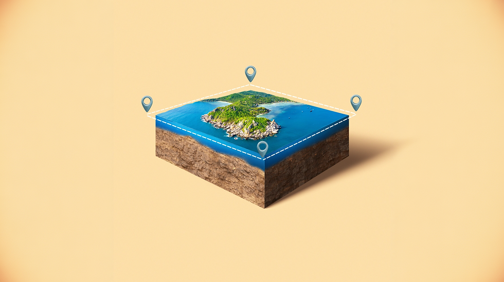
The technique of using both GIS mapping and CAD systems together is amazing, giving the best results. Engineers can easily work with both location data and design drawings, and that too, at the same time.
Moreover, GIS mapping helps them to get to the skin of real-world details. Be it other site features, roads or utilities and terrain. In order to create precise technical designs, CAD is mostly used. So when these two tools are used together, it becomes much easier to see how a design fits into the actual project location.
This helps engineers study the site more clearly and make better decisions during planning and design.
In this blog, we’ll look at how GIS mapping and CAD integration work together, how spatial data supports engineering projects, and the steps involved in implementing this workflow.
What is GIS?
So, what’s GIS? The full form is Geographic Information System. Usually, it’s a way to work with data tied to real-world locations. You collect, organize, and dig into information based on where things actually are. Once you map that data, it shows up on interactive maps such as layers of points, lines, and shapes spread across the landscape.
With this setup, you can see what’s going on in a point of area and understand how all the pieces connect.
Key Components and Functions
Data Integration: Mixes spatial info like satellite images and GPS with details about the area demographics, infrastructure, and where businesses are.
Layering: Lets you stack different datasets, like roads, population, and environmental stuff, with the help of which you can easily see how everything gets connected.
Interactive Visualization: Any raw data is converted into visual maps, like heat maps or shaded choropleths, so you can actually see what’s going on.
Spatial Question Solving: Answers big questions like “Where is this?” “What’s happening there?” and “How does it connect to everything else?”
Common Applications
Business: GIS helps in business to find the best places. This can be to set up shop, streamline your shipping routes, and really dig into the market.
Govt and Urban Planning management: GIS helps to manage any sort of infrastructure, public services and sorting zoning issues.
Environmental Science: With GIS, changes in the climatic situations are easily tracked as they happen. GIS also helps in keeping an eye on natural resources, and actually takes care of forests.
Management of Emergencies: The role of GIS arises when disaster strikes. GIS shows us exactly what’s unfolding and sends help straight to where it’s needed, fast.
For more details on GIS concepts, visit Esri’s GIS Overview.

GIS mapping vs CAD
GIS mapping digs into spatial analysis. CAD, on the other hand, is what you use when you need to draft and model things with real precision, such as buildings, roads, or bridges. The real magic is when engineers use these two together.
So it’s not just lines and shapes floating on a screen anymore. You simply get to see your project on the map, and get a true sense of how everything fits together in the actual landscape.
Key Differences Between GIS and CAD
Feature | GIS | CAD |
Purpose | Models the world (land use, spatial relationships) | Models objects for construction/production |
Coordinate Systems | Real-world geographic coordinates (lat/long) | Local Cartesian or relative coordinates |
Data Structure | Topology and attribute data | Geometry-focused (lines, shapes) |
Accuracy | Large-scale, multi-source data | High precision for engineering and design |
GIS Mapping + CAD Mapping Integration
Data Migration: CAD designs can be converted into GIS format for spatial analysis.
Improved Efficiency: Environmental and infrastructure impacts can be analyzed using CAD designs within GIS.
Workflow: The design work is handled by CAD, while those designs to be fit into the real world are what GIS does.
Common software: GIS – ArcGIS, QGIS | CAD – AutoCAD, MicroStation, Solidworks

GIS-CAD Work Integration
Blending GIS with CAD links engineering designs directly to real-world locations. It’s simple to transfer important info between programs, no more jumping through hoops. With tools like ArcGIS for AutoCAD and FME, everything just works together smoothly. Engineers get what they need faster, and projects just move along better.
Key Components
Coordinate System Alignment: Ensures CAD drawings align with GIS coordinates for accurate overlays.
Layer Mapping & Conversion: Converts CAD layers and attributes into GIS feature classes.
Bidirectional Data Access: Allows editing GIS data within CAD and importing CAD data into GIS.
Improved Design Context: The decision-making process gets improved with the help of GIS layers. They are utility maps, LiDAR, and aerial imagery.
Common Use Cases
CAD drawings can be combined with underground utility data. This helps track assets and makes maintenance easier.
Want to see if road plans follow zoning or planning rules? Just lay them over topographic maps and you’ll spot any problems right away.
Organize and update land parcels directly in CAD with the help of ArcGIS Parcel Fabric.
No more bouncing between different software. You get things done faster, with way less hassle.
Best Practices for GIS-CAD Integration
Audit CAD files for layers, linework, and coordinate systems.
Use specialized tools like ArcGIS for AutoCAD or FME for efficient data translation.
Validate GIS topology to ensure accurate spatial analysis.
Spatial Analysis for Projects
Spatial analysis can help engineers to turn location data into useful data. Tasks like project site selection, city planning, or searching for better routes are done seamlessly. ArcGIS and QGIS tools help to make it easier to study patterns, measure distances, and understand routes.
Core Applications
City Planning and Infrastructure Development: Study land use, zoning rules, and existing infrastructure.
Environmental Observation and Tracking: Monitor land cover, habitats, and natural resources.
Logistics & Transportation: Optimize routes and reduce operational costs.
Site Selection: Evaluate multiple layers to identify ideal locations for facilities.
Public Health: Map disease spread and plan healthcare access.
GIS Spatial Analysis Techniques
Distance Analysis: Measure how far locations are from specific features, such as homes within 1 km of a river.
Data Layer Comparison: Combine different datasets like soil type, slope, and vegetation to -determine site suitability.
Surface Analysis: Use DEMs to calculate slope, aspect, and viewsheds.
Network Analysis: Determine optimal routes and service areas.
Spatial Statistics/Hot Spot Analysis: You get to identify any kind of clusters or such outliers, for smart decision-making.
For more details on spatial analysis, you can check out GIS Navigator.

Environmental Data
Environmental Data and GIS mapping make it quite easy to know what’s happening in a particular area. You would search different reports or datasets manually initially. There would be one digital map with GIS mapping having all the information.
GIS mapping comes into the picture by covering the layers like topography, biodiversity, and land cover to support sustainable planning and Environmental Impact Assessment (EIA).
Key Applications
Biodiversity and conserving the environment: Track different species' lives and how their habitats are changing over time.
Checking environmental impact before projects begin: GIS mapping helps in checking out any ecologically sensitive areas, before you plan to do any kind of construction work
Hazards other than risks management: GIS helps you to identify the risks from floods, wildfires, or oil spills.
Land planning and resource management: GIS supports planners in analyzing which areas are suitable for development and also managing natural resources responsibly.
Tracking all kinds of pollution: Air, soil and water, GIS tracks and visualizes the pollution present in them. It becomes easier to identify problem areas and take action.
Advantages
Improved visualization for easier decision-making.
Enhanced spatial analysis for trends and relationships.
Data integration from multiple sources for holistic insights.
Evidence-based decisions supporting sustainable engineering.
Explore GIS for Environmental Analysis for examples.
Utilities Mapping
GIS mapping makes utility mapping way easier. It lets people track and manage important networks: water, gas, electricity, and telecom, without the headache. When you blend GIS with CAD designs, planning gets smarter, risks drop, and you can watch systems in real time.
Key Features
Asset Management: Tracks location, condition, and maintenance.
SUE: Finding underground utilities before construction
Network Analysis: Monitors infrastructure performance.
Digital Twins: 3D interactive models for simulation and planning.
Field Data Collection: Updates asset data in real time.
Advantages
Cost savings via optimized maintenance schedules.
Enhanced safety by preventing accidental utility damage.
Data-driven decisions for urban development and long-term planning.

Asset Management
With GIS-based asset management, spatial maps are connected with infrastructure data so organizations can monitor and maintain their assets in real time.
Benefits
Asset Mapping & Visualization: Clear location and condition of assets.
Proactive Maintenance: With predictive maintenance, things run smoothly and help in cutting the costs.
IoT Integration: You can track performance and spot problems the moment they happen.
Field Data Collection: Updates asset status in remote locations.
Enhanced Decision Making: Spatial analytics for risk and compliance.
Common Applications
GIS mapping keeps utility networks running smoothly. It helps teams track and manage everything, making daily operations a lot easier and more efficient.
And yes, it helps map systems like the water pipelines, gas lines, and the electricity distribution. This way, it makes it much easier to monitor and maintain them.
Cities also depend on GIS mapping for managing public infrastructure. With it, they can keep track of roads, bridges, and many other urban assets across the city.
GIS mapping is also useful in facility management. Inside buildings, it helps teams monitor systems like HVAC units and fire safety equipment, making them easier to organize and maintain.
Tools & Platforms
Most of the GIS mapping projects revolve around ArcGIS. The team handles all the geospatial data, keeps it sorted and easy to find.
Out in the field, people pull out apps like ArcGIS Field Maps or Survey123 to collect info right then and there.
If you look at bigger organizations, they rely on enterprise asset management systems like IBM Maximo to keep track of their infrastructure and schedule what needs fixing.
Lately, cloud-based GIS platforms have made a huge difference.
They let teams get to their data from anywhere and actually work together, which is a lifesaver when there’s a bunch of departments involved.

Software Tools (ArcGIS, QGIS)
ArcGIS and QGIS are leading GIS platforms for GIS mapping and GIS CAD integration.
Feature | ArcGIS | QGIS |
License | Proprietary | Open-source |
Platform | Windows | Cross-platform |
Best Use | Enterprise, large-scale projects | Cost-effective, flexible, customizable |
Mapping & Analysis | 3D modeling, raster/vector, LiDAR | Advanced cartography, plugins, raster/vector |
Support | Professional support | Active open-source community |
ArcGIS is perfect for large organizations requiring enterprise support. QGIS suits individual users or small teams seeking flexibility and low cost.
Implementation Steps
Effective GIS mapping implementation follows a structured approach:
1. Planning & Goal Definition
- Define objectives for logistics, asset management, or environmental monitoring.
- Direct feasibility studies and outline project scope.
2. Requirement Review
- Identify stakeholder needs and desired functionality.
- Assess the present workflows for improvement opportunities.
3. System Design & Data Modeling
- Design database and spatial data architecture.
- Define necessary basemaps and thematic layers.
4. Data Acquisition & Conversion
- Collect existing data or create new datasets through GIS surveying.
- Preprocess, clean, and geocode data for compatibility.
5. System Implementation & Development
- Install GIS software. Such as ArcGIS/QGIS and hardware infrastructure.
- Conduct pilot projects and customize applications for workflows.
6. Operation, Maintenance & Training
- Train users to ensure adoption.
- Maintaining, updating, and backing up the data regularly.
- Review system performance for continuous improvement.

FAQs
1. What is GIS mapping in engineering projects?
Above all else, maps built with GIS show where things are, like helping teams shape plans before work begins. When details matter, location becomes a quiet guide through design choices. Instead of guessing, decisions grow from what the land reveals. Step by step, space turns into insight.
2. How is GIS different from CAD?
A map sees connections through space; GIS digs into those links. Design demands accuracy down to the last line, something CAD builds from the ground up.
3. What is GIS-CAD integration?
Fresh views on projects come when CAD drawings enter GIS spaces. Inside geographic systems, those plans gain meaning through location-based layers. Instead of sitting alone, blueprints connect with real-world data around them. Spatial context turns static sketches into dynamic references. Understanding grows once design details meet mapping intelligence.
4. What instruments help create maps using geographic information systems?
ArcGIS pairs with apps such as QGIS, mixing distinct ways to map spaces. Yet another option pops up with Spatial Manager, handling data transfers smoothly across platforms. FME enters the picture by linking systems without needing constant manual checks. Meanwhile, Autodesk Connector for ArcGIS bridges design workflows with geographic data setups.
5. How does GIS support environmental analysis?
Starting with hazard maps, it stacks resource information on top while folding in how people use the land. Ending by balancing all three at once.
6. Can GIS mapping help with utilities management?
Finding buried lines? It shows those. Pipes up top too, mapped clearly. Location details pop into view when needed. Underground networks gain visibility through layered displays. Above-surface systems appear just as easily. Mapping both happens at once, without switching tools.
7. What is spatial analysis in GIS?
Patterns show up when location information gets analyzed. Where things connect becomes clear through spatial details. Best paths emerge from how points relate across space.
8. Comparing ArcGIS and QGIS?
Focused on enterprises, ArcGIS stands apart. Open source by design, QGIS offers flexibility across platforms instead.
Why is GIS mapping important for site selection?
It evaluates multiple factors like topography, land use, and proximity for optimal decisions.
How do implement GIS mapping in a project?
Follow steps: planning, requirements analysis, system design, data acquisition, implementation, and maintenance.
Maps do more than mark spots on a surface. See connections unfold across actual ground instead of wondering what fits where. Designs grow clearer when set upon the land they belong to - geography gives meaning. Spot trends hiding in open view, then rethink how plans take shape. Layouts paired with place-aware insights make errors vanish slowly. When fog lifts, choices gain edge. Turn to PrimaVerse once understanding slips away
A fresh mix of sketches and location views changes project planning. Tools work together, linking layout ideas with real spaces. This approach shapes how teams organize tasks. New methods adjust the way work moves forward. Seeing both design and map details helps rethink each step.
Contact PrimaVerse to learn how our GIS and CAD solutions can transform your project planning and execution.


Comments